


Drake Voting District, Gasconade County, Missouri
About
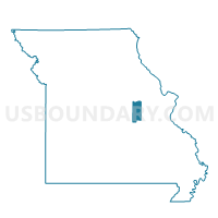
Outline

Summary
| Unique Area Identifier | 607846 |
| Name | Drake Voting District |
| County | Gasconade County |
| State | Missouri |
| Area (square miles) | 36.79 |
| Land Area (square miles) | 36.65 |
| Water Area (square miles) | 0.13 |
| % of Land Area | 99.64 |
| % of Water Area | 0.36 |
| Latitude of the Internal Point | 38.47239830 |
| Longtitude of the Internal Point | -91.43733300 |
Maps


Graphs
Select a template below for downloading or customizing gragh for Drake Voting District, Gasconade County, Missouri


Neighbors
Neighoring Voting District (by Name) Neighboring Voting District on the Map
- Boulware Voting District, Gasconade County, MO
- DETMOLD Voting District, Franklin County, MO
- JAEGERS SHOP Voting District, Franklin County, MO
- Rural Canaan Voting District, Gasconade County, MO
- Swiss Voting District, Gasconade County, MO
Top 10 Neighboring County Subdivision (by Population) Neighboring County Subdivision on the Map
- Canaan township, Gasconade County, MO (5,339)
- Lyon township, Franklin County, MO (3,816)
- Boeuf township, Gasconade County, MO (1,087)
- Boulware township, Gasconade County, MO (642)